![The Warm Northernmost Road: Soya Scenic Byway [Scenic Byway Hokkaido Part 3]|Domingo](https://p1-634a4370.imageflux.jp/w=768,f=webp:auto,q=78/https%3A%2F%2Fdomingo.ne.jp%2Fwp%2Fwp-content%2Fuploads%2F2021%2F10%2F4bb5bc0c87652795e2b804af24b27bcb.jpeg)
ARTICLES
The Warm Northernmost Road: Soya Scenic Byway [Scenic Byway Hokkaido Part 3]


This Route's Coordinator

This Drive's Route
Soya Scenic Byway
The Soya Scenic Byway, which includes the Rishiri-Rebun-Sarobetsu National Park, is a region blessed with rich nature nurtured by a harsh environment. It features stunning sights like the magnificent Mount Rishiri-Fuji, the Sarobetsu Wetlands stretching to the horizon, Rebun Island where alpine plants can be seen from sea level, and the vast periglacial landscape of the Soya Hills. This area also boasts expansive dairy farms that utilize the natural surroundings and rich fishing grounds, forming Japan's northernmost area that offers culinary delights as well.
Let's Head Out for a Drive!
 1
White Road (Soya Hills)
1
White Road (Soya Hills)
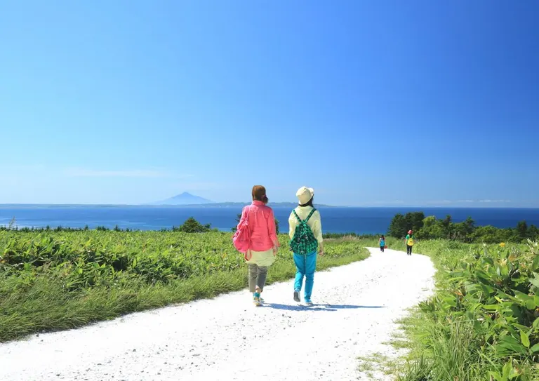
The "White Road" in the Soya Hills is a path stretching for about 3 km, paved with crushed scallop shells, a specialty of Wakkanai. The beautiful contrast between the blue sky and sea, the green flora, and the white road has become a hot topic, making it a popular scenic spot on social media and beyond in recent years.
Wakkanai Tourist Information
■Location
Soya, Soya-mura, Wakkanai-shi
■Map Code
805 842 637*74
■Map
2
Bakkai Line (Ororon Line)
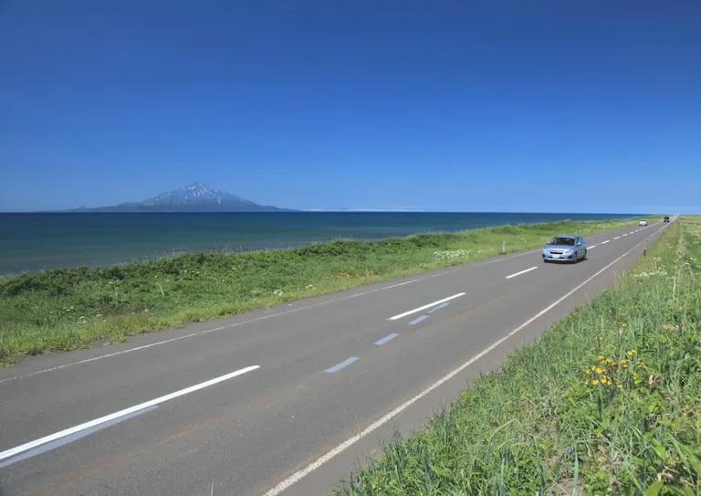
This is the highlight section of the "Ororon Line," which runs from Otaru to Wakkanai. From Toyotomi Town, where you enter the Rishiri-Rebun-Sarobetsu National Park, man-made structures disappear, creating a spectacular road you can only experience here. As you head north towards Wakkanai, you'll see the Sea of Japan and Mount Rishiri on your left. The sunset over Mount Rishiri is also highly recommended.
Wakkanai Tourist Information
■Location
Wakasakunai, Toyotomi-cho, Teshio-gun
■Map Code
908 104 243*10
■Map
3
Esanuka Line
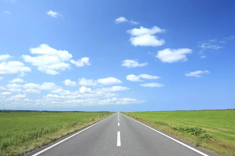
The "Esanuka Line" runs from Sarufutsu Village to Hamatonbetsu Town. This straight road, stretching about 16 km as if to the horizon, is popular with bikers and tourists. There are no guardrails or utility poles along the entire route, and plains spread out on both sides, allowing you to enjoy an incredibly open and spectacular view.
Sarufutsu Village Tourism Association
■Location
Asajinodaiji, Sarufutsu-mura, Soya-gun
■Map Code
869 725 441*34
■Map
4
Large-Scale Grassland Farm
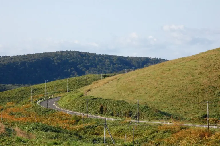
With a total area of 1,500 hectares, this is one of Japan's largest grassland farms. The European-like hilly landscape, with grazing cows and pastoral scenes of hay rolls, is perfect for a drive. It's also recommended for stargazing.
The road has many ups and downs, but with an electric-assist bicycle, it's a breeze. Please consider using a rental cycle.
■Location
Kamifukunaga, Toyotomi-cho, Teshio-gun
■Map Code
766 660 244*02
■Map
5
Wakkanai Brand
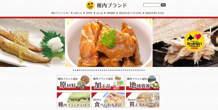
Products utilizing agricultural, livestock, and marine resources born from the rich nature of the northernmost region, as well as Wakkanai's proud cultural and natural resources, are certified as the "Wakkanai Brand" and promoted widely both domestically and internationally. The certified products all convey the charm of Wakkanai and are recommended as souvenirs. As of June 2020, 7 raw materials (ingredients), 25 processed goods, and 4 regional resources have been certified.
Wakkanai BrandSummary
This route makes you want to just keep going, whether by car, bicycle, or on foot. It made the Domingo editorial team eager to experience the crisp, clear air created by the mountains and sea of Northern Hokkaido.As you head into autumn and winter in Hokkaido, make sure you're well-prepared with infection prevention measures and studless tires, and enjoy your drive!
 Scenic Byway Hokkaido
Started in 2005, as of December 2019, there are 13 designated routes and 3 candidate routes, with about 440 organizations participating.