SPOT
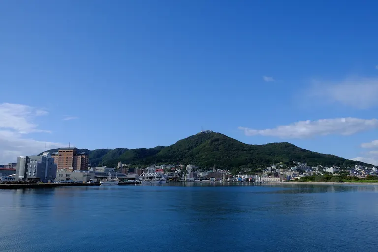
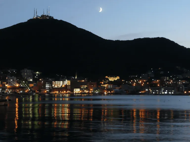
Hakodate Mountain


Overview
At an elevation of 334m, from its appearance "like a cow lying down," it is also called "Gagyuzan." From the Meiji Era until Showa 20 (1945), it was used as a fortress and became off-limits, and even now, traces of war such as gun batteries remain.
Mount Hakodate was a volcanic island formed by ancient volcanic activity. Sediment accumulated and became a sandbar, and approximately 5000 years ago, it connected with Hokkaido (Kameda Peninsula), becoming the current topography of Hakodate (tied island).
From Meiji to the end of the Pacific War, it became a military fortress, and because general citizens were off-limits, as a result, rich nature such as plants and wild birds has remained. In 1964 (Showa 39), it was designated as a wildlife protection area special protection zone.
It is formed by 12 mountains connected together, and from its appearance like a cow lying down, it is called "Gagyuzan" (Gagyuzan). From the mountaintop observation deck, in addition to being able to enjoy the miraculous night view, hiking routes are also maintained at the foot of the mountain, and mountain walking while enjoying nature and scenery is possible. At the starting point, the Hakodateyama Fureai Center, hiking information such as maps can be obtained.
Business Hours
Details Regarding Hakodate City official tourism information "Hakobura" object please see.
regular closing day
For details, please see Hakodate City official tourism information "Hakobura".
Fee
For details, please see Hakodate City Official Tourism Information "Hakobura".
Location
Postal Code 040-0000
Hokkaido Hakodate City Hakodate Mountain