SPOT
Sōya Hills


Overview
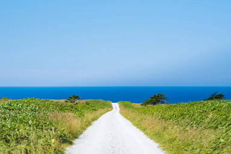
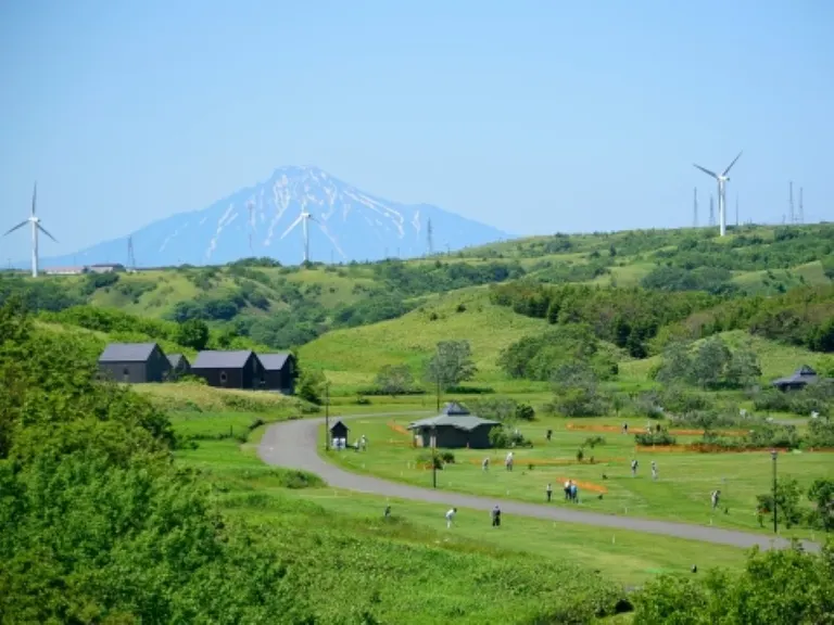
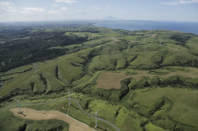
When you climb and proceed on the highland spreading behind Cape Soya, a "mound-like" gentle hilly terrain, which characterizes the mountainous region of Wakkanai, comes into view. This "mound-like" terrain becomes about 20m to 200m in height, the ridge lines are rounded, and the valleys are extending in a dendritic shape, this terrain is said to be one of the "periglacial landforms."
In the Wakkanai region, while the phenomenon of soil freezing then melting, and melting then freezing was repeating, a solifluction phenomenon occurred on the slopes, the soil on the upper part of the slopes was eroded away, and it accumulated in the lower valleys, making the ridges and slopes gentle, and small valleys were created. This was formed during the Earth's last ice age, the "Würm Glaciation," which occurred 20,000 to 10,000 years ago.
Such "periglacial landforms" are said to have been formed everywhere in Hokkaido, but due to development and so on, the landscape has been lost, and it can be said that the "Soya Hills" is where beautiful terrain can still be clearly seen even now.
Until the middle of the Meiji era, dense forests were growing thickly over the entire area of the hills, but due to successive wildfires, now, the entire area is covered by pasture land by Soya Misaki Ranch and dwarf bamboo. And the Soya Hills, where one can enjoy a "landscape as if it were not Japan," which was thus created, was designated as Hokkaido Heritage in Heisei 16 (2004).
Location
Wakkanai City Soya Hills