ARTICLES
The Road Trip of a Lifetime: The Japan Sea Ororon Line ~ Scenic Byway Hokkaido (10)


This Route's Coordinator

This Drive's Route
Moeru Tenpoku Ororon Route
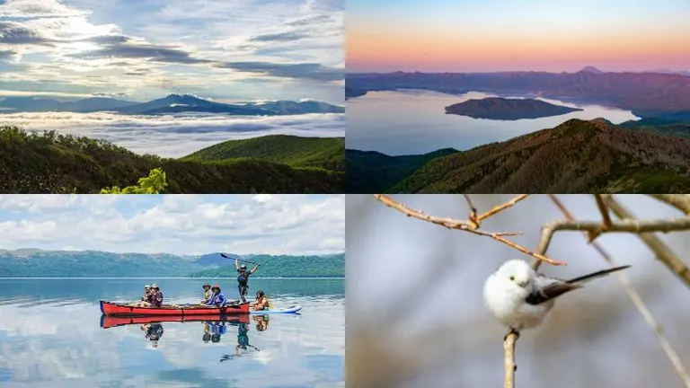
Located in the northern part of Hokkaido's Sea of Japan coast, the Moeru Tenpoku Ororon Route, also known as the Japan Sea Ororon Line, offers the charm of witnessing a way of life that has continued amidst a harsh yet beautiful natural environment. It features stunning natural landscapes, including the mountain ranges of Mt. Shokanbetsu, views of Teuri and Yagishiri islands, and the "Stairs of the Sunset."
Let's Hit the Road!
 1
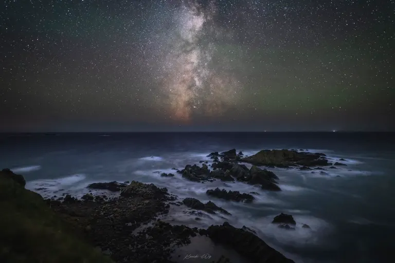
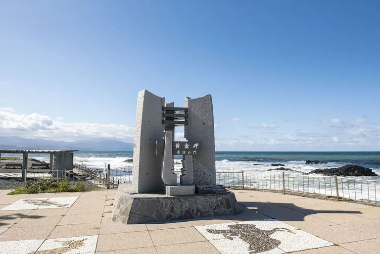
Kogane Misaki Cape
1
Kogane Misaki Cape
Scenic Byway Hokkaido Dohoku Route Partnership Photo Contest 2019, Moeru Tenpoku Ororon Route Award Winner: "Enveloped in Morning Mist" (Photo by Keiichi Saito)
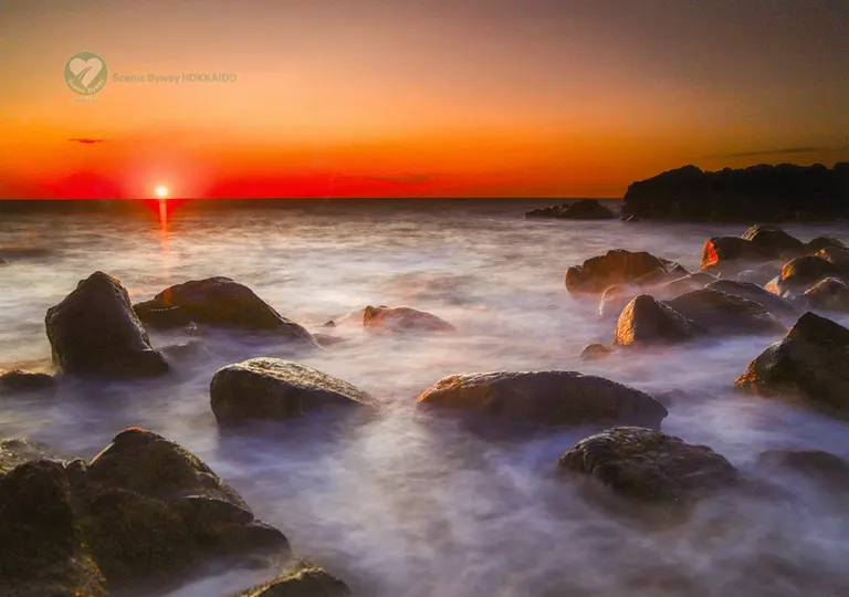
This cape, once a lookout post for herring, came to be called "Kogane Misaki" (Golden Cape) because the schools of herring (known as "kuki"), illuminated by the setting sun, would rush towards the shore, shimmering in a golden color.
Kogane Misaki is a coast with a unique landscape of numerous rugged, strangely shaped rocks. The sun setting into the ocean dyes everything in its light, and the view moves visitors, earning it the name "Japan's most beautiful sunset."
 Kogane Misaki Cape
■Location
2-chome, Omachi, Rumoi City
■Contact
0164-43-6817 (Rumoi Tourist Association)
■Map Code
416 390 328*75
■Map
2,3
Teuri Island & Yagishiri Island
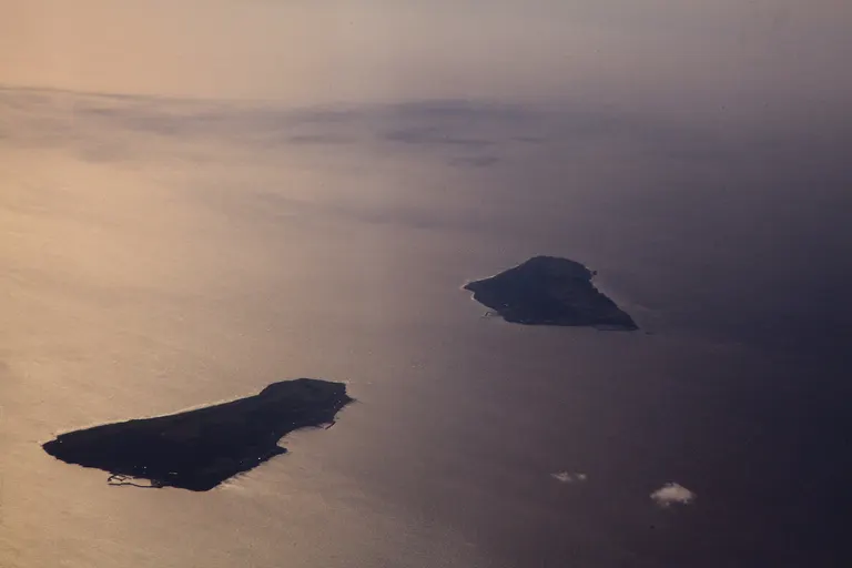
Scenic Byway Hokkaido Dohoku Route Partnership Photo Contest 2014, Entry: "Teuri Island and Yagishiri Island" (Photo by Eiji Yokoyama)
Teuri Island is one of the world's leading breeding grounds for seabirds. Rare seabirds such as the common murre (ororon bird) and spectacled guillemot, as well as the rhinoceros auklet, build their nests here.
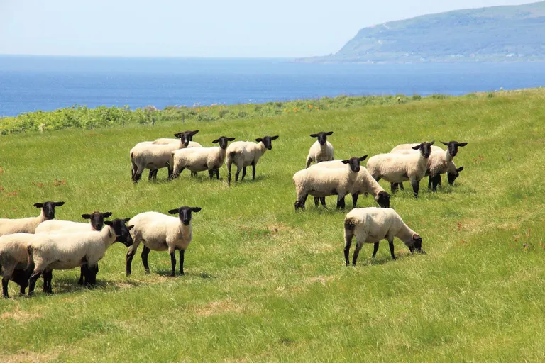
The sight of a wide variety of seabirds flying across the sky from spring to early summer is truly spectacular. Yagishiri Island is an island of flowers and primeval forests, with one-third of the island covered by a forest designated as a natural monument.
Sheep are grazed in the pastures in the center of the island, creating a peaceful and idyllic landscape.

■Location
Haboro-cho, Tomamae-gun
■Map Code
929 310 870*77 (Haboro Town Teuri Branch Office) / 929 381 463*22 (Haboro Town Yagishiri Branch Office)
■Map
4
Sankebetsu Brown Bear Incident Reconstruction Site
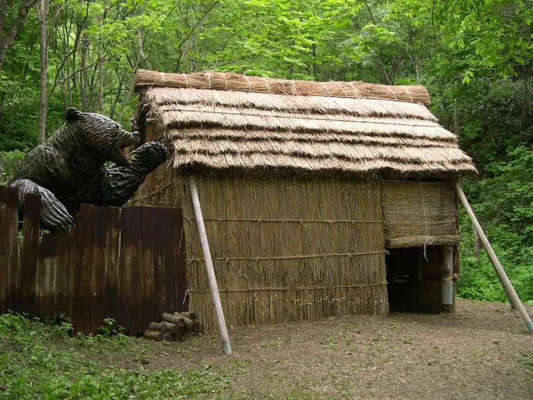
About 30km from the Tomamae town center is the "Sankebetsu Brown Bear Incident Reconstruction Site," which conveys a tragic story from the pioneering era to future generations.
Near the site of the incident in 1915, where a settlement of pioneers was attacked by a giant brown bear, a hut from the pioneering days and a replica of the giant bear have been reconstructed.
The atmosphere is so palpable it feels like a brown bear could appear at any moment, making it a thrilling and secretly popular tourist spot.
■Location
Sankei, Tomamae-cho, Tomamae-gun
■Contact
0164-64-2212 (Tomamae Town Office, Commerce, Labor and Tourism Division, Commerce, Labor and Tourism Section)
■Hours
May 1, 2021 - Late October
There are no set opening hours, but please refrain from visiting at night as it is dangerous.
■Map Code
818 456 667*80
■Map
5
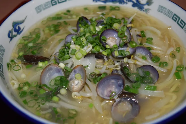
Teshio Onsen Yubae Restaurant
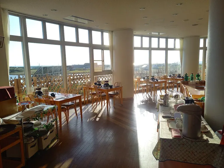
Savor the Yubae special shijimi ramen, made with an abundance of Teshio-produced freshwater clams. This is a scenic cafe where you can relax with a peaceful view overlooking the Sea of Japan and Kagaminuma Kaihin Park.
The restaurant is attached to lodging facilities and a hot spring (day-use available). With its brownish, slightly viscous water and views of the sunset over the Sea of Japan from the bath, it is a popular relaxation spot for many town residents.
 Teshio Onsen Yubae Restaurant
■Location
5807-4 Sarakishi, Teshio-cho, Teshio-gun
■Contact
01632-2-3111
■Hours
Lunch 11:30 AM - 2:15 PM (Last order 1:45 PM) / Dinner 5:30 PM - 8:00 PM (Last order 7:30 PM)
■Map Code
830 734 865*78
■Map
6
Otonrui Wind Farm

This is a group of windmills along Prefectural Road 106, which runs along the coastline north of the Teshio River mouth. "Otonrui" means "road on the beach" in the Ainu language. This landscape has long been cherished as a sacred spot for motorcycle touring, with 28 windmills lining the road for about 3km.
In early summer, pink Japanese roses (hamanasu) bloom, creating a picturesque scene with the blue of the sky, the green of the Sarobetsu Wetland, and the white of the windmills in harmony.

■Location
32-4 Hamazato, Horonobe-cho, Teshio-gun
■Map Code
736 189 721*23
■Map
Conclusion
What did you think?This route was a journey where you could fully enjoy the sky, which changes its expression with the time of day. There are also many delicious foods nurtured by the great outdoors, making the Ororon Route a place that satisfies both body and soul. It's truly the best.
Since it's a time when long-distance travel is difficult, we hope you can also enjoy driving and discovering wonderful spots near you.
 Scenic Byway Hokkaido
Started in 2005, as of the end of December 2019, there are 13 designated routes and 3 candidate routes, with about 440 organizations involved.
Scenic Byway Hokkaido
Read More!
Recommended for readers of this article
・Journey to the Great Northern River, the Teshio River, where untouched nature and people harmonize. [Scenic Byway Hokkaido (15)]
・The Warmest Northern Road, Soya Scenic Byway [Scenic Byway Hokkaido (3)]
Topics near this article's location
・Towards a sea where giant Pacific octopus can be caught forever. The sustainable fishing practices of Tomamae Town's fishermen.
・Community development in Sarufutsu Village, "Japan's northernmost village," utilizing the hometown tax donation system.