ARTICLES
A 126-Year-Old Map of Hakodate Pushed on a Japanese Tourist in Germany - What Does It Reveal!?


A tweet from Iskra-san (https://twitter.com/DDRplanet) about an old map of Hakodate purchased at a flea market has sparked a massive response.
今片付けてたら以前ドイツの蚤の市で日本人だから買うのだ!と強引に買わされた函館の地図が出てきました…
— イスクラ コメコンデザイン・東ドイツ東欧雑貨・社会主義建築 (@DDRplanet) April 21, 2022
明治29年(1896年)9月30日発行 pic.twitter.com/o3xMEeeni1
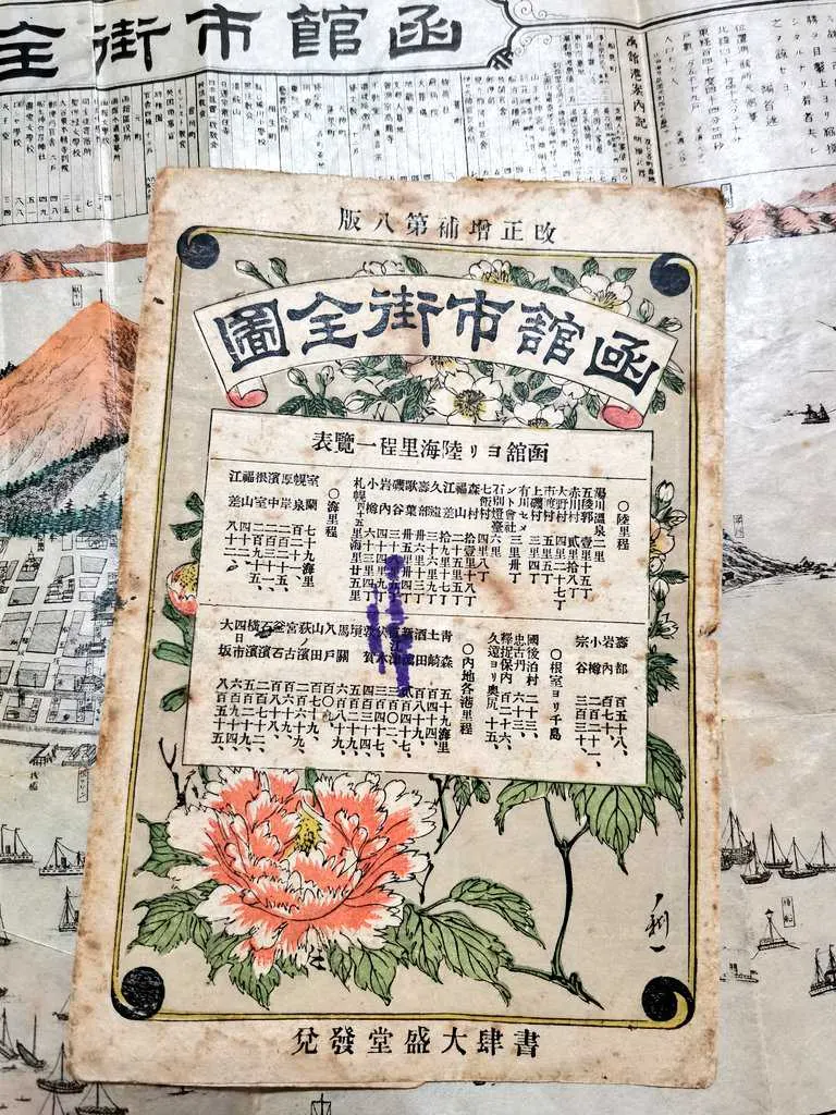
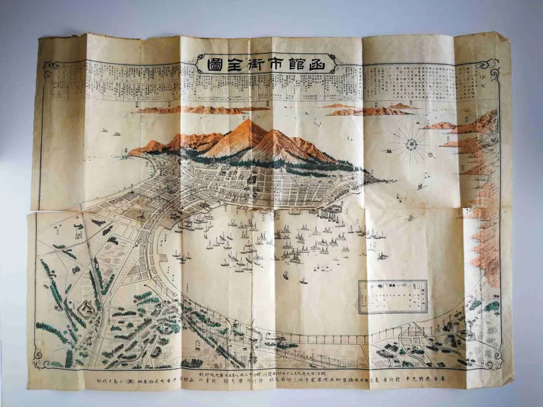
The old map was issued on September 30, 1896 (Meiji 29), making it an incredible 126 years old. Despite its age, the map's surface is adorned with beautiful flowers, offering a glimpse into the vibrancy of Hakodate at the time.
Iskra-san, who purchased the map, has been selling European miscellaneous goods online since 2005. We had the opportunity to speak with them.
――Where did you purchase this map?
It was at a flea market in eastern Germany in 2011. I go on buying trips to European flea markets about twice a year, and I bought it on one of those trips.
――What was your interaction with the shopkeeper like?
I was looking at other maps when they practically forced it on me, saying, "You must be interested in this, right? You're Japanese." (laughs) I usually sell antique European goods (ISKRA ONLINE SHOP can be found here) and also handle old maps, so I decided to buy it, thinking someone might want it.
――What kind of map is it, exactly?
It's a city map of Hakodate, a single sheet measuring about 55cm by 44cm. It wasn't in great condition, with tears along the folds.
――How did you feel about the reaction on Twitter this time?
I tweeted about it when I bought it in 2011, but there was no reaction then, so I just stored it at home. I thought it might be better off in a museum, but the years went by and I'd forgotten about it. Then, the other day, I was reading "Golden Kamuy" and there's a scene where a train crashes through Hakodate Station into the sea, which reminded me, "Hey, I have a map from that era!"
Thank you, Iskra-san!
So, what kind of map is this exactly? We asked Satoru Wada (https://twitter.com/satoru_wada), a city-walking researcher also known as "Bura Satoru," to take a look.
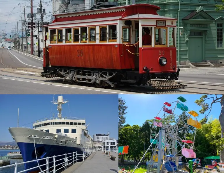
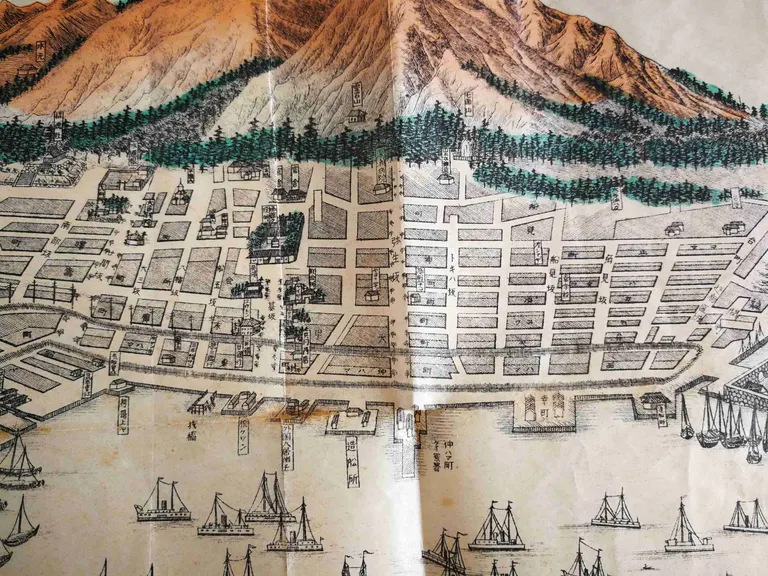
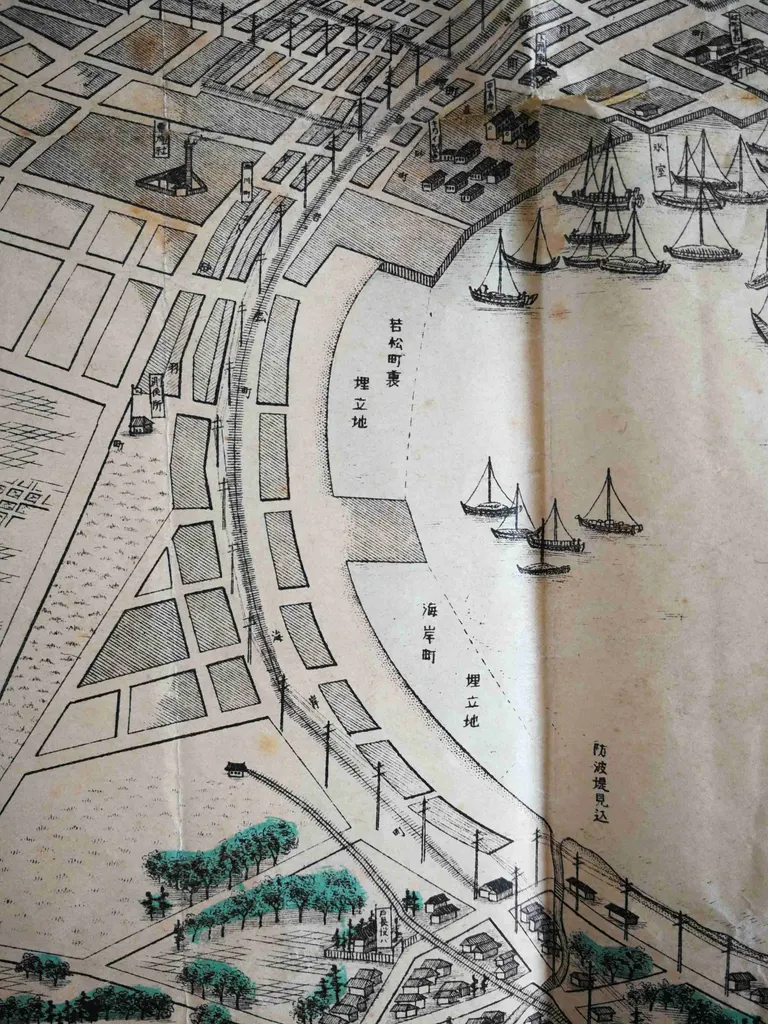
This map was issued in 1896 (Meiji 29). This was the year before the horse-drawn tramway, the predecessor to the city's streetcar system, opened, and six years before the Kanso Railway, the predecessor to the JR lines, began service. Of course, the Seikan Ferry didn't exist yet either. All the railway lines depicted are proposed routes, and you can see that the starting point of the Kanso Railway, the first Hakodate Station, was located in Kaigan-cho, which is further north (closer) than the current station.
The city center was in what is now the Seibu (western) district, and it is drawn prominently with the Hakodate Ward Office in Motomachi Park at its core. The city center gradually shifted to the Jujigai and Hakodate Station areas following the later opening of Hakodate Station and repeated fires.
What's also interesting is that Goryokaku is not depicted. Today, Goryokaku is a major tourist attraction, but at the time, memories of the Battle of Hakodate were still raw. Perhaps there was a decision not to deliberately depict a symbol of the former shogunate forces, who were enemies of the new government. (Satoru Wada)
(Addendum added June 1, 2022)
After checking a high-resolution image of the same map available on the website of the International Research Center for Japanese Studies, I found that Goryokaku was indeed depicted in the bottom-left corner. Considering that the Hekketsuhi monument, which commemorates the war dead of the former shogunate forces at the foot of Mt. Hakodate, is also drawn with its name, my assumption that historical sites related to the Battle of Hakodate and the former shogunate forces were taboo was incorrect. I apologize and offer this correction, and I thank the person who pointed this out. (Satoru Wada)
Looking at the old map again with Mr. Wada's explanation, the situation in Hakodate becomes even clearer. This old map, chanced upon in a German flea market, has traveled through more than 100 years to teach us about the city as it was back then.
You might also like!
Recommended for readers of this article
・Go Fishing at a Shrine! The Cute "Ezo-mikuji" at Iwanai Shrine with its Long Approach and History
・Explore the Charm of Bricks and Pottery! The Ceramic Art Center in Ebetsu, the City of Bricks
Topics near this article's location
・Featuring Hakodate's "Squid-licious" Fortunes! Yukura Shrine, the Guardian Deity of Yunokawa Onsen
・A Junior High School in Hakodate, Its Graduation Ceremony and Songs Amidst the COVID-19 Pandemic